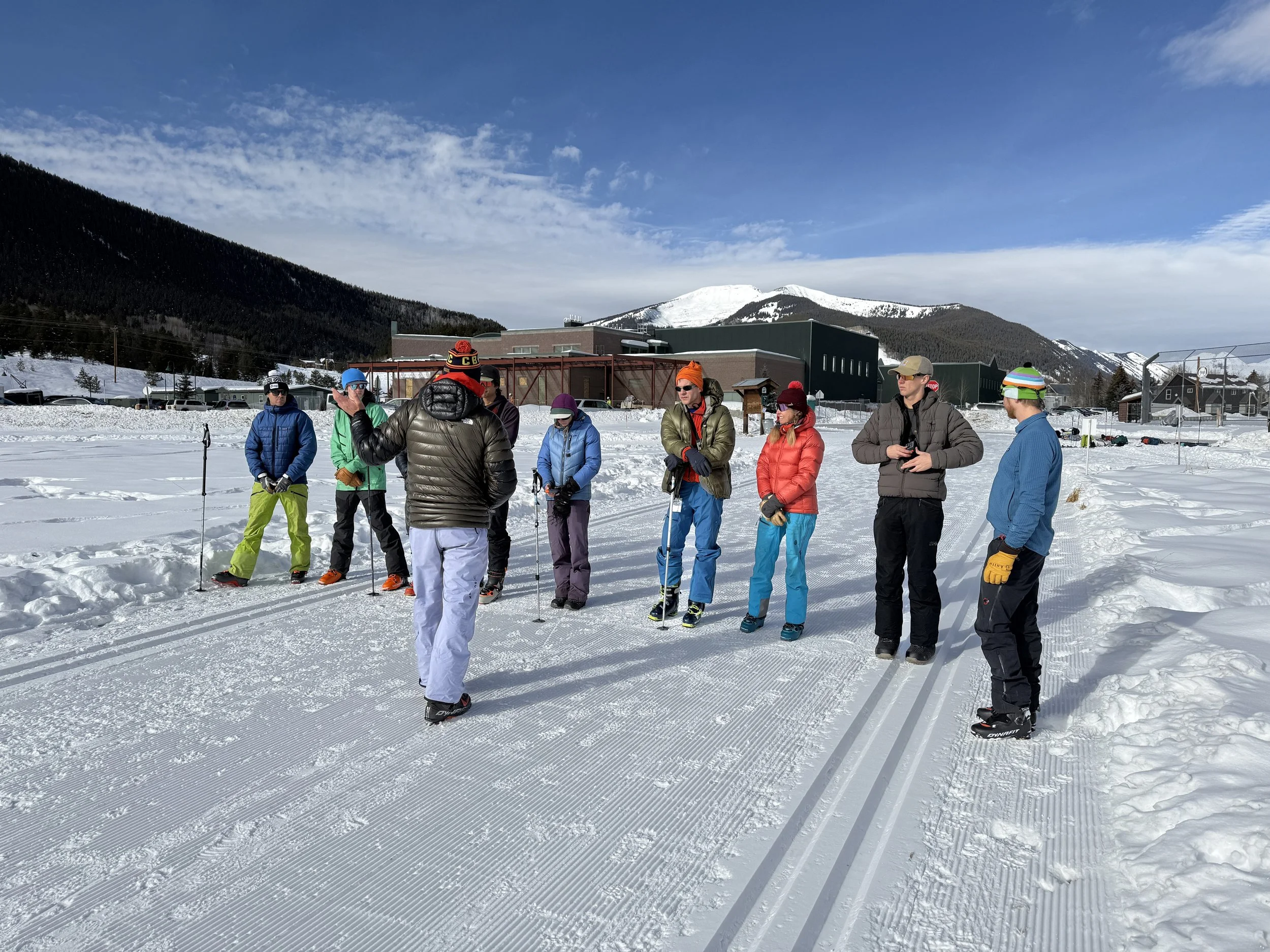
What makes AspectAvy revolutionary?


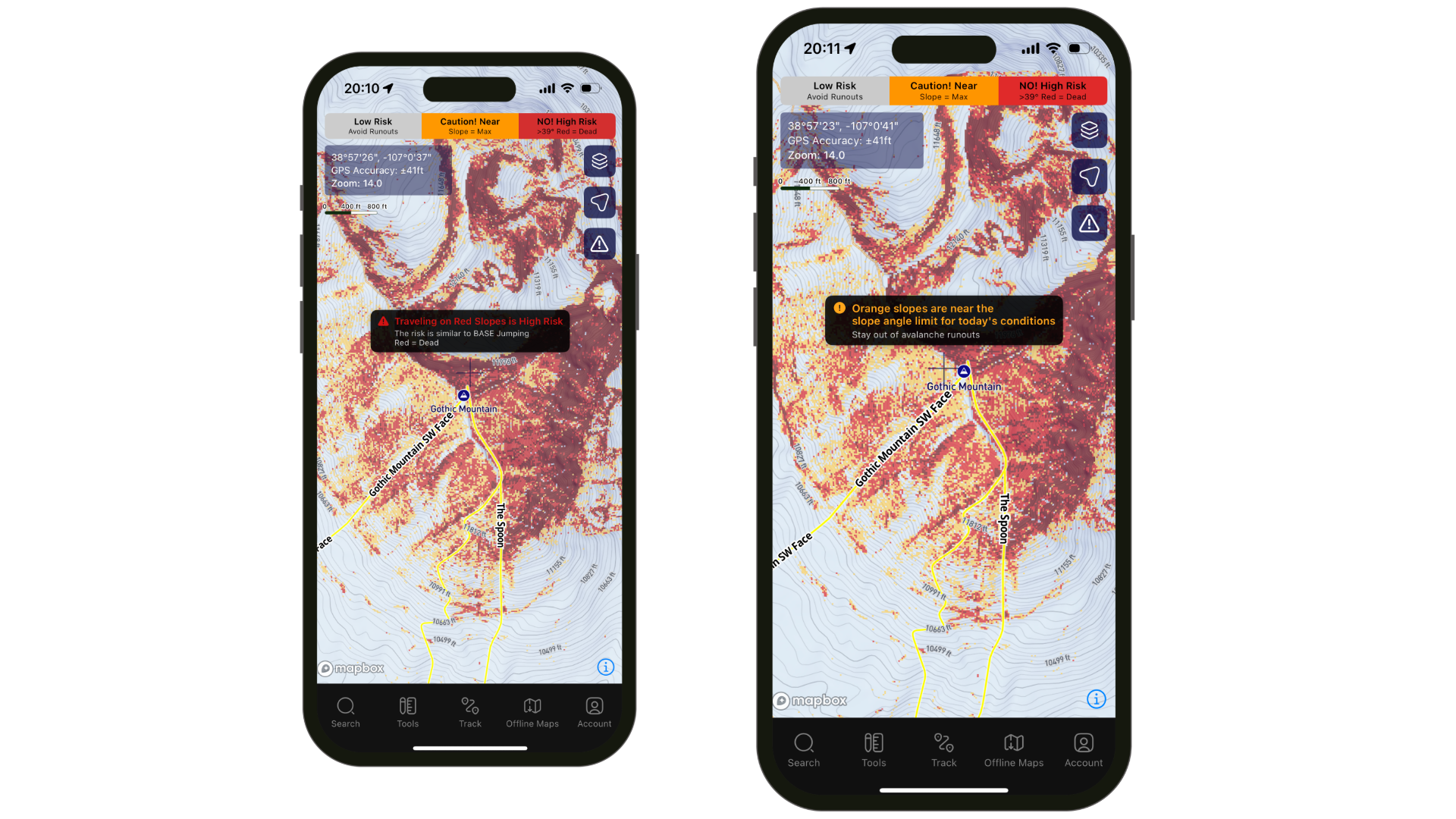
Adaptive Slope Shading (A.S.S.)
Adaptive Slope Shading is the output of our proprietary algorithm, it updates and changes as the conditions change. Simply put, it is the red layering you see when you’re looking at the map in the app. Our shading is a yes or no system. Red is high risk for today's avalanche danger, and we recommend avoiding these slopes. Clear is low risk, these are the areas that are extremely unlikely for an avalanche to be triggered.

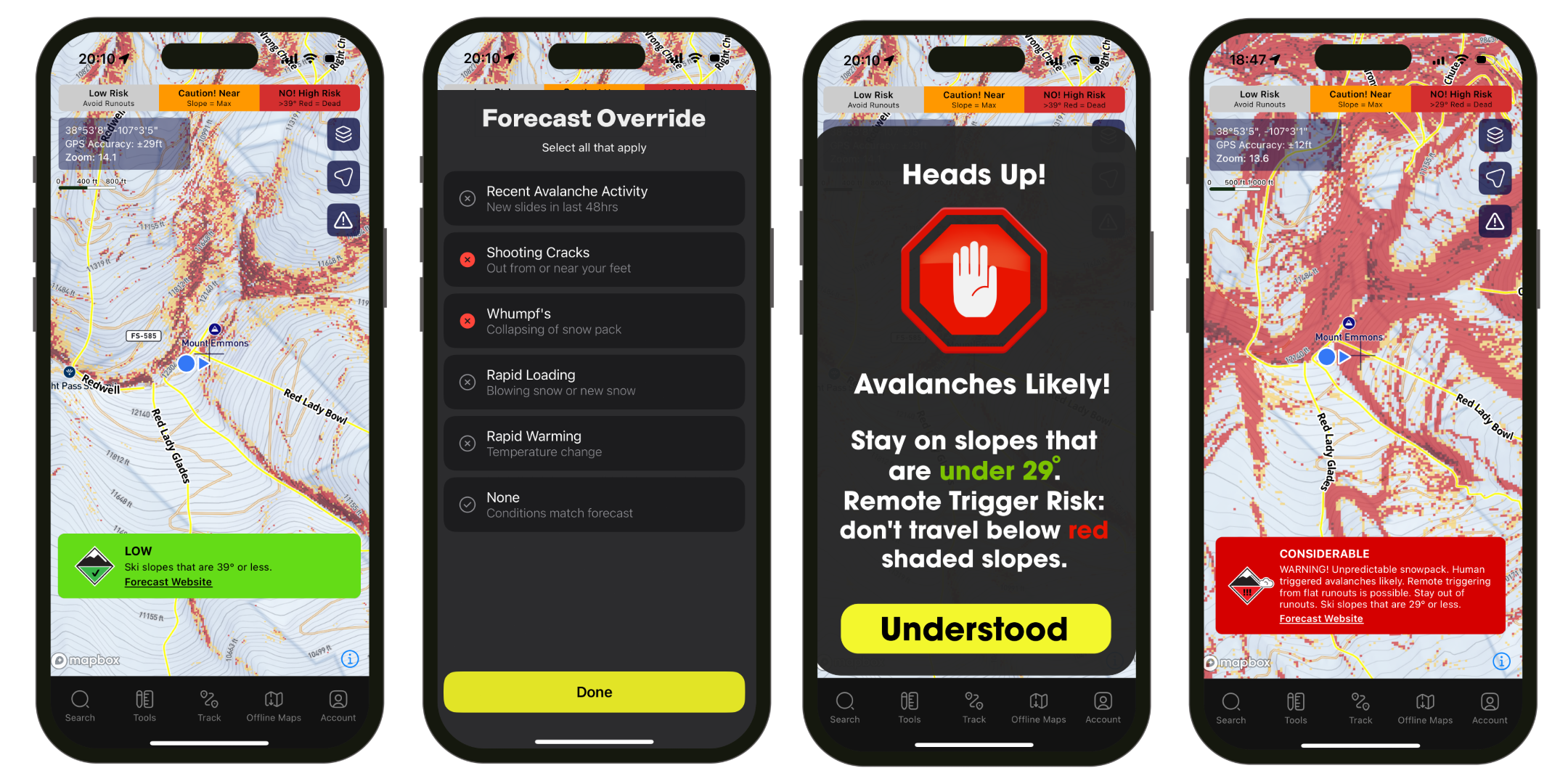
Override Forecast
Conditions are constantly changing and evolving throughout the day and the avalanche forecast may not be accurate in your zone. AspectAvy is the only tool that allows you to override the forecast if snow conditions are more dangerous than the forecast predicted. Tap the alert icon to bring up the menu. Select the snow conditions that you are experiencing, e.g. Shooting Cracks or Whumpfs, then tap Done. ASS will update the slope shading based on your input and show you the new High/Low risk zones.
Try it out!

Intelligent Risk Labeling
The Risk Label gives users a clear description of the risk level of anywhere you hover over on the map. Move the crosshairs around the map to see the danger levels in the zone you’re looking to explore. This layer can be toggled on or off.


2500+ Classic Ski Routes
AspectAvy has thousands of classic ski routes, up-tracks, and approaches built into the map. These routes are marked in yellow on the map and can be toggled on and off.
Avalanche Death Data (A.D.D.)

The Avalanche Death Data layer marks each location where an avalanche fatality has occurred. These locations are marked by the red skull and crossbones icon. Tap the icon to bring up the official report and compare conditions. This layer can be toggled on or off.


Runout Angle

Cross Slope Angle
Slope Angle Meter
Quickly measure the angle of a nearby slope. There are two different tools to help you do this, and the angle line is color coded. Green = Low Risk, Yellow = Be Careful , Red = High Risk.